It's Big Trip Time! Part 2 - Overarching Grandeur
Did you read Part 1? You probably should - it might have been kinda boring, but it's probably necessary background on this whole shebang.
On the last blog, we'd driven through Monument Valley and were continuing our first day's travel on the big trip, heading for Moab, Utah.
Delicate Arch, in Arches National Park
Check the people for scale (it's big)!
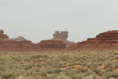
After finishing our drive through John Ford's favorite scenery, we entered the towns of Mexican Hat and Bluff, Utah. Legend has it that a Mexican cowboy fell in love with a Native American maiden, who was unfortunately already married to an evil magician; the magician dealt with his rival by turning him to stone and plunking him (and his fancy hat) on top of a nearby outcropping, as a reminder to all who passed by.
Here he is! Technically, he's upside down.
Also, technically, I believe the "Mexican Hat" in question
is actually referred to as a "sombrero."
The formation behind the hat is known as Navajo Rug,
due to its swirling, woven-like patterns.
Both Mexican Hat and Bluff are cute little towns that seem to exist mainly due to being close to neat rock formations, like those in Arches and Monument Valley (they are also former mining towns - lots of minerals here). It is fun to drive through them, even if they're just a tiny blip in this part of the country.
More cool formations in the area.
The Twin Rocks Cafe in Bluff,
located just below those two spires on the left.
As we left Bluff, the La Sal Mountains came into view; we'd see their west side again from Arches National Park, but right now, we were coming at them from the south. Early Spanish explorers named these mountains, as their coloring made them look like huge piles of salt ("la sal").
Both of these shots are of the La Sal's along our route;
the difference in landscape is mainly due to elevation.
We had huge swings in altitude throughout this trip,
particularly on this day.
Home is around 1200 feet above sea level,
Flagstaff is 7000, Monument Valley is around 5000,
and Moab is around 4000.
Growing up in coastal central Florida, I think the highest point
near us was a freeway overpass (~25 feet above sea level),
so how altitude impacts landscape is still fascinating to me.
Although hauling a tiny house behind you wherever you go is great in a lot of ways, it also means you can't always explore quite as much as you want to, or at least as much on the fly. We saw a few cool things like the ones in the shots below, and since we had the trailer, we had to pass them by. Maybe next time!
Yeah, pretty much no idea what this thing was,
other than just another cool rock formation.
We named it the Blorp (since someone just "blorped" it down there).
It had a hole in the bottom, and we figured that meant
that beings called "blops" lived inside it.
Almost 10 hours in a truck is a long time, y'all.
This place looked rad, too.
Not only was there a hiking trail to the aptly named hole,
but if you can enlarge this, you can probably see
the stuff out front - random sculptures and yard art,
including a lizard adhered to the side of the mountain.
So sad we didn't stop here.
After a very, very long drive, we arrived without issue in Moab around 4pm, and we found our location within the Slickrock RV Resort. Since we knew the drive would be long today, we sprung for a pull-through, full hookup site (details, for those who want them - we ended up in spot #31 - booked in early February and paid in advance - $50 per night before taxes); driving for 10 hours and then trying to back the rig into a spot while we're tired, hungry, and whatnot is a one-way ticket to Divorce City, that's for sure. After working quickly to get most items on the rig hooked up, we changed into hiking boots and headed into Moab proper.
Although we'd brought food to make a quick pasta dinner in Arlene, Moab has several appealing dining options that looked open and weren't too crowded; we found ourselves at the Trailhead Public House and Eatery, located inside an adobe building dating from the late 1800s that had previously served as a post office, general store, and hotel. We split an order of the pork green chile poutine and a salad (balance, that's what it's about), and we enjoyed some local brews, too.
Noms!
(Craft beer aficionados will rightly call me out
that my beer is local-ish, being brewed in Salt Lake City.
Chris' was from Moab Brewery, which was just down the road)
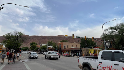
On our stroll back to the truck,
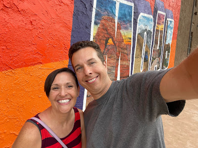
we grabbed some shots of Moab itself,
including at the selfie wall.
Even though we'd had a long day, we knew we wouldn't have much more of a chance to see Arches National Park, and we really didn't want to miss out on it. Tired though we were, adventure time wasn't over yet here, and it was back in the truck and to our first National Park of the trip! We didn't really have time to do a proper hike (and we were tired - see above), but we drove part of the scenic tour (and read along to the Frommer's Guide while we went). To the pictures!
We're here at the Park Avenue viewpoint;
this is looking back at the set of switchbacks
that greet you just inside the entrance to the park.
While you can camp within the park,
I personally wouldn't want to drive a rig up those
(unlike other national parks, Arches has just the one entrance).
Although the sun was starting to come out just a bit,
dark skies were still looming.
Our next stop on the driving tour was to take a peek at Balanced Rock, a boulder weighing around 3600 tons, perched on a teeny, tiny little spire that was slowly eroding away.
Although we like to convince ourselves that rock formations
like this will take generations more to finally collapse,
the park has numerous recent examples of arches crashing down
(as recent as 2008), their supports finally giving up the ghost.
(as recent as 2008), their supports finally giving up the ghost.
I wouldn't want to be standing underneath them,
should that happen.
We drove out the small detour from the main road to see the Windows Section of the park, including the North and South Window arches.
We didn't do more than stop here, use the bathroom,
and take pictures, but you could hike up to this arch,
as you can see from the line of people in the picture
(another reason why we didn't - ugh, people).
Our final destination in the park was Delicate Arch; you can hike to this arch, and we wanted to do so, but (to sound like a broken record) we were tired, so we picked the short trail to the Arch Overlook instead. As it turns out, the "short" hike to the overlook winded us enough, so it was a decent choice not to do the full hike (the real hike is about 3 miles round-trip, across tough, exposed slickrock). We still got some decent shots, including the one at the top of this post:
Enlarge for a pano
Some of that slickrock on the left of this shot
The green color in some of these shots is caused by
soils and areas with different minerals,
including (potentially) reduced iron.
This is not the geology blog you're looking for.
The people for scale in these shots just kills me.
You don't quite realize how freaking BIG these things are
until you're right there.
Chris kept saying that Delicate Arch looked like pants to him;
as it turns out, early names for this arch included:
The Chaps
The Schoolmarm's Bloomers
and, my favorite,
Pants Crotch.
Thanks, Wikipedia, for that.
On our way back down to the parking lot, we heard one lady ask her friend if there were more arches in the park. Her friend replied in the affirmative, which is a bit of an understatement - at last count, Arches NP had over 2000! We really loved Arches NP; like the Grand Canyon, it truly feels like landscape on an epic scale, and it's stunningly beautiful in a southwestern/red rock-y kind of way. Arches was also one of the less congested parks we visited on our trip (although that may have been more about timing than anything else), and it's a big area, so you feel as if you can explore it without too much other human interference. We'll be back for sure!
Fully tuckered out, we headed back to the RV resort, where we changed into comfy clothes and split a brew; we chilled out on the provided picnic table at our spot and listened to our neighbors cheerfully scream at each other (and their dog - I can't tell you how many times we heard KODA! as their pup tried to escape and come sit by us, their much quieter neighbors) until around 10pm, when we retired for the evening.
On the next blog, we bid adieu to Moab and follow the trail of the Mormon pioneers - straight to Salt Lake City!
Later!
Amy


Comments
Post a Comment